
Wild disturbances are on the rise, while land disturbed by human activity has been decreasing.
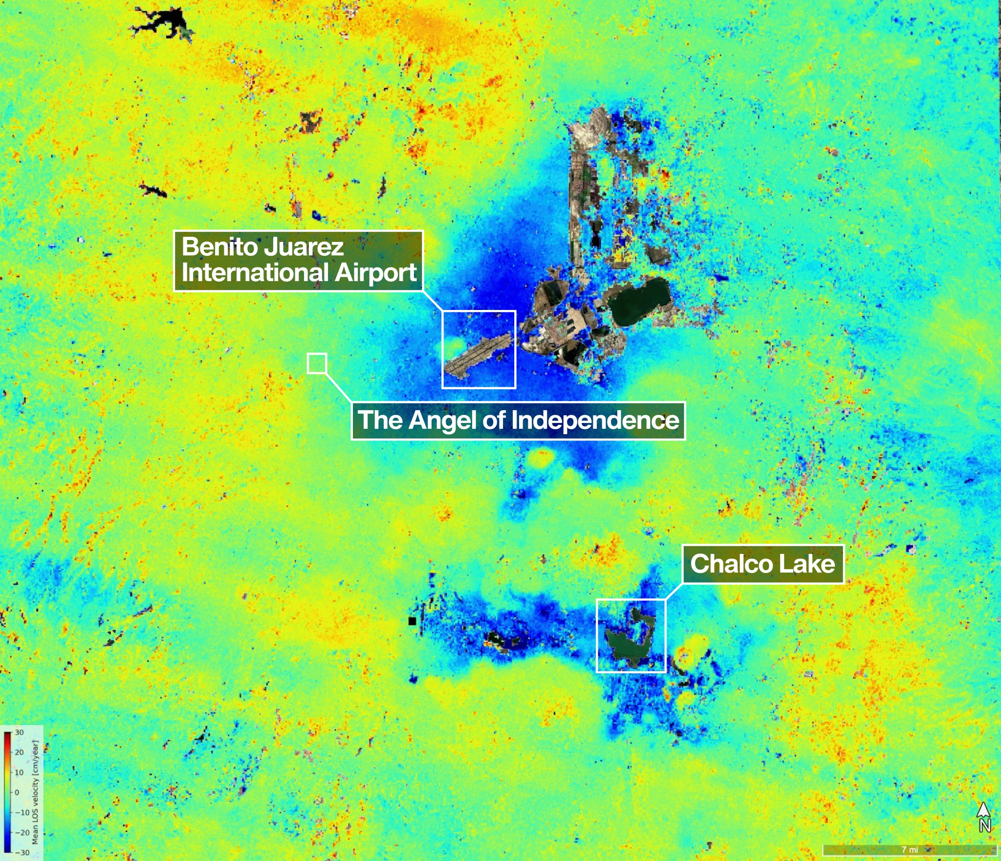
One of the most powerful radar systems ever launched into space has mapped the ground moving beneath one of fastest subsiding capitals in the world: Mexico City. The findings show how quickly and reliably the NISAR (NASA-ISRO Synthetic Aperture Radar) satellite can track real-time changes across Earth’s surface from orbit, unhindered by clouds or vegetation […]

The state was unusually dry for much of 2025, but the intensity of the drought has ratcheted up since January 2026.
A new data visualization illustrates how an experimental NASA technology can provide extra lead time to communities in the path of a tsunami. Called GUARDIAN (GNSS Upper Atmospheric Real-time Disaster Information and Alert Network), the software detects slight distortions in satellite navigation signals to spot hazards on the move.. The animation breaks down a real-life […]