
For the second consecutive year, winter sea ice in the Arctic reached a level that matches the lowest peak observed since satellite monitoring began in 1979. On March 15, Arctic sea ice extent reached 5.52 million square miles (14.29 million square kilometers), very close to the 2025 peak of 5.53 million square miles (14.31 million […]
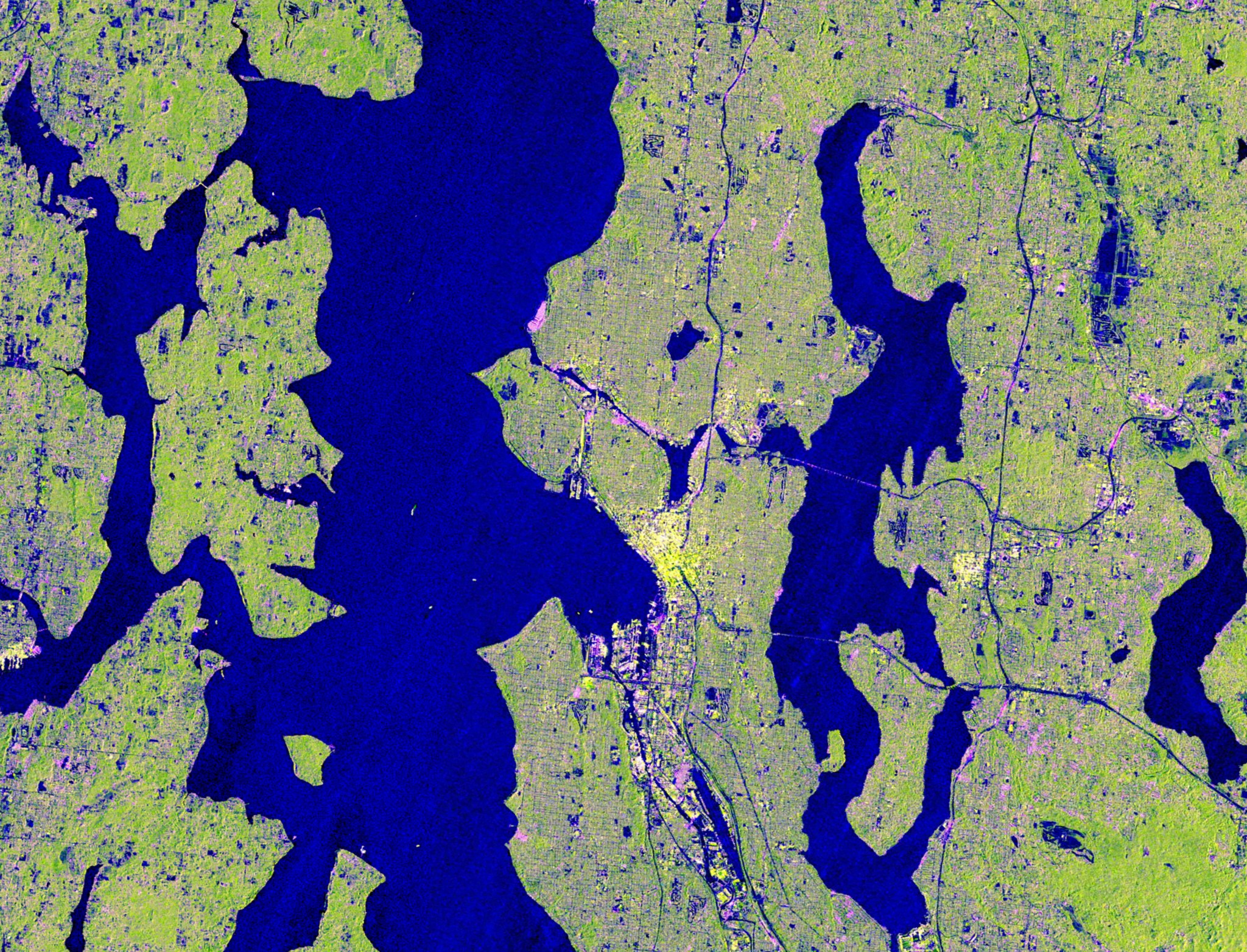
Seattle and Portland, Oregon, are among the cloudiest cities in the United States. But that infamous cloud cover is no match for the U.S.-Indian Earth satellite NISAR (NASA-ISRO Synthetic Aperture Radar), which is designed to peer straight through clouds. Doing so allows scientists to study the Pacific Northwest’s natural landmarks and bustling port cities like […]
A new data visualization illustrates how an experimental NASA technology can provide extra lead time to communities in the path of a tsunami. Called GUARDIAN (GNSS Upper Atmospheric Real-time Disaster Information and Alert Network), the software detects slight distortions in satellite navigation signals to spot hazards on the move.. The animation breaks down a real-life […]

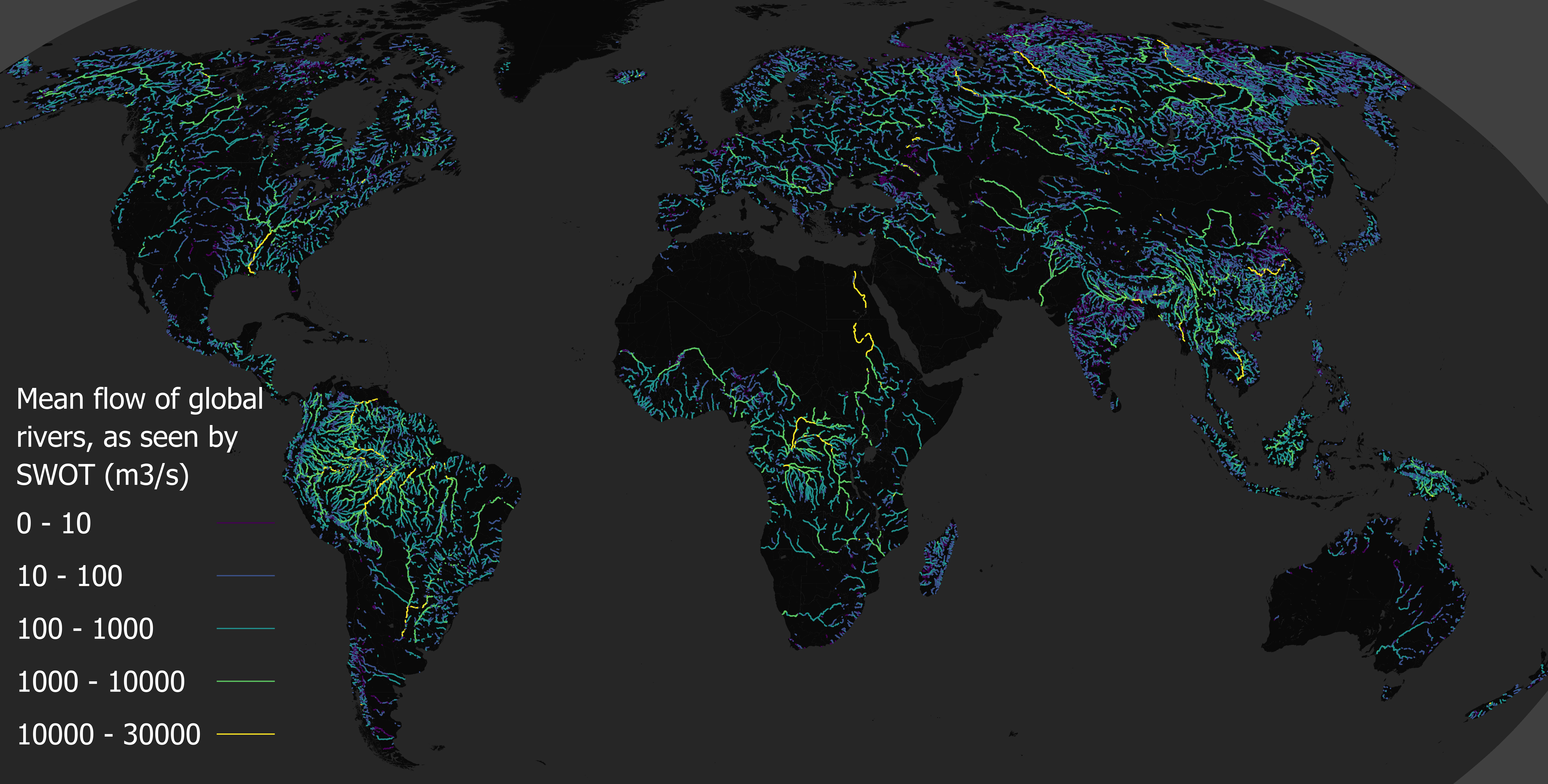
Explore how rivers move, change, and sustain life across the planet with SWOT data.
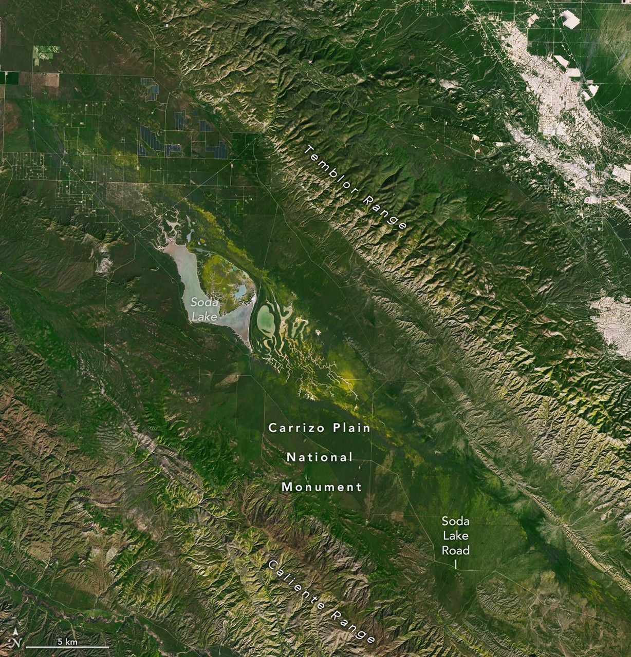
Plains around the San Andreas Fault and across Carrizo Plain National Monument are awash with yellow as wildflowers bloom.

A NASA laser reflecting technology that will aid Global Positioning System (GPS) accuracy is now operational as of March 9. The instrument, known as a laser retroreflector array, or LRA, launched aboard GPS III SV-09, the ninth of U.S. Space Force’s Block III Global Positioning System satellites, on Jan. 27. LRAs are sets of mirrors […]
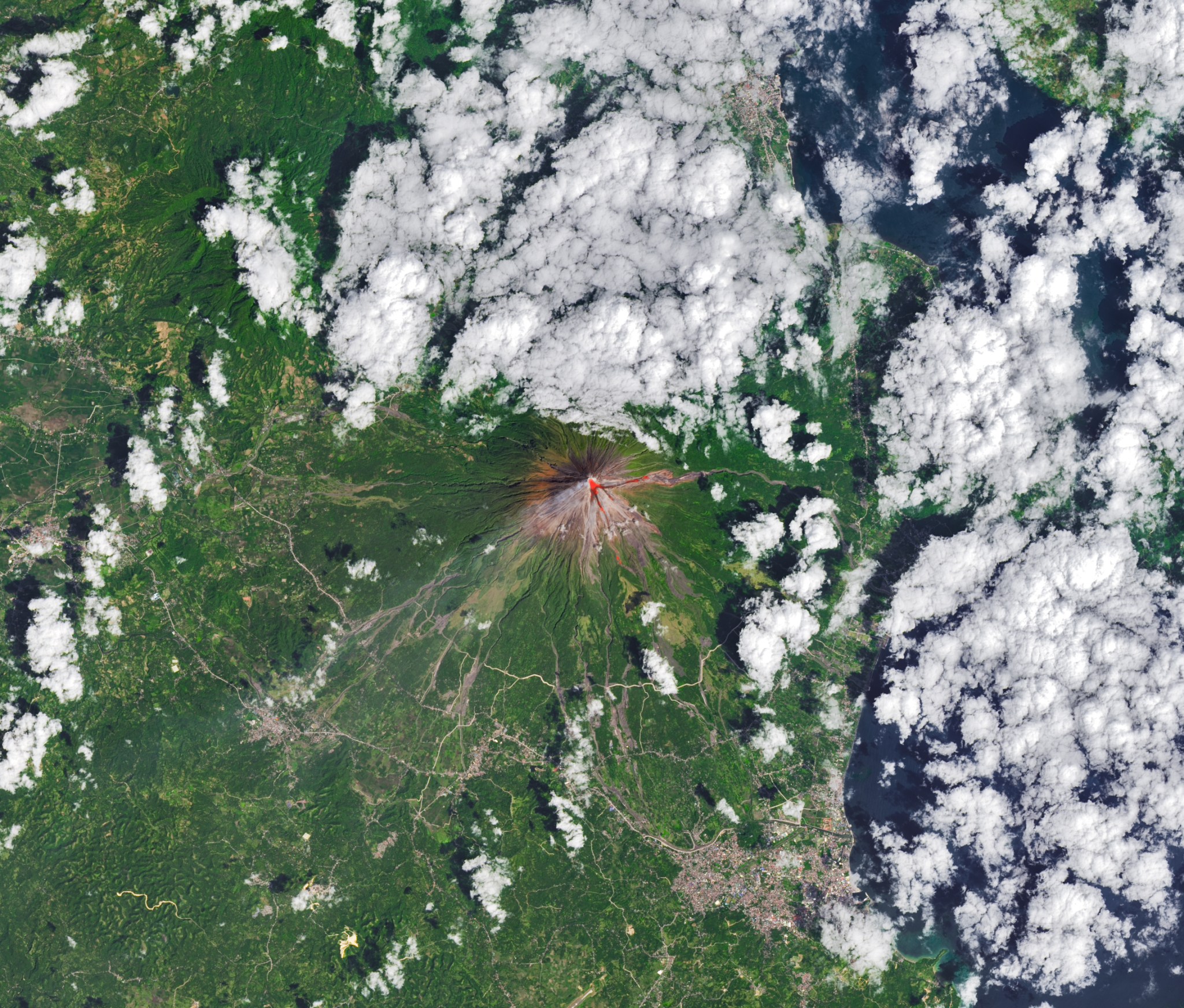
The OLI (Operational Land Imager) on Landsat 8 acquired this rare, relatively clear image of Mayon, the most active volcano in the Philippines, on Feb. 26, 2026. The natural-color scene is overlaid with infrared observations to highlight the lava’s heat signature. On that day, the Philippine Institute of Volcanology and Seismology (PHIVOLCS) reported volcanic earthquakes, rockfalls, and hot clouds of ash […]
The dust storm created travel complications and other issues for Texans.

Ireland is best known for its many greens, but the striking grays of the island’s Burren region also stand out in satellite images.
A new NASA satellite image has captured a rare view of an erupting volcano, revealing its bright red lava flow as seen from space.
…