Icy Hudson River
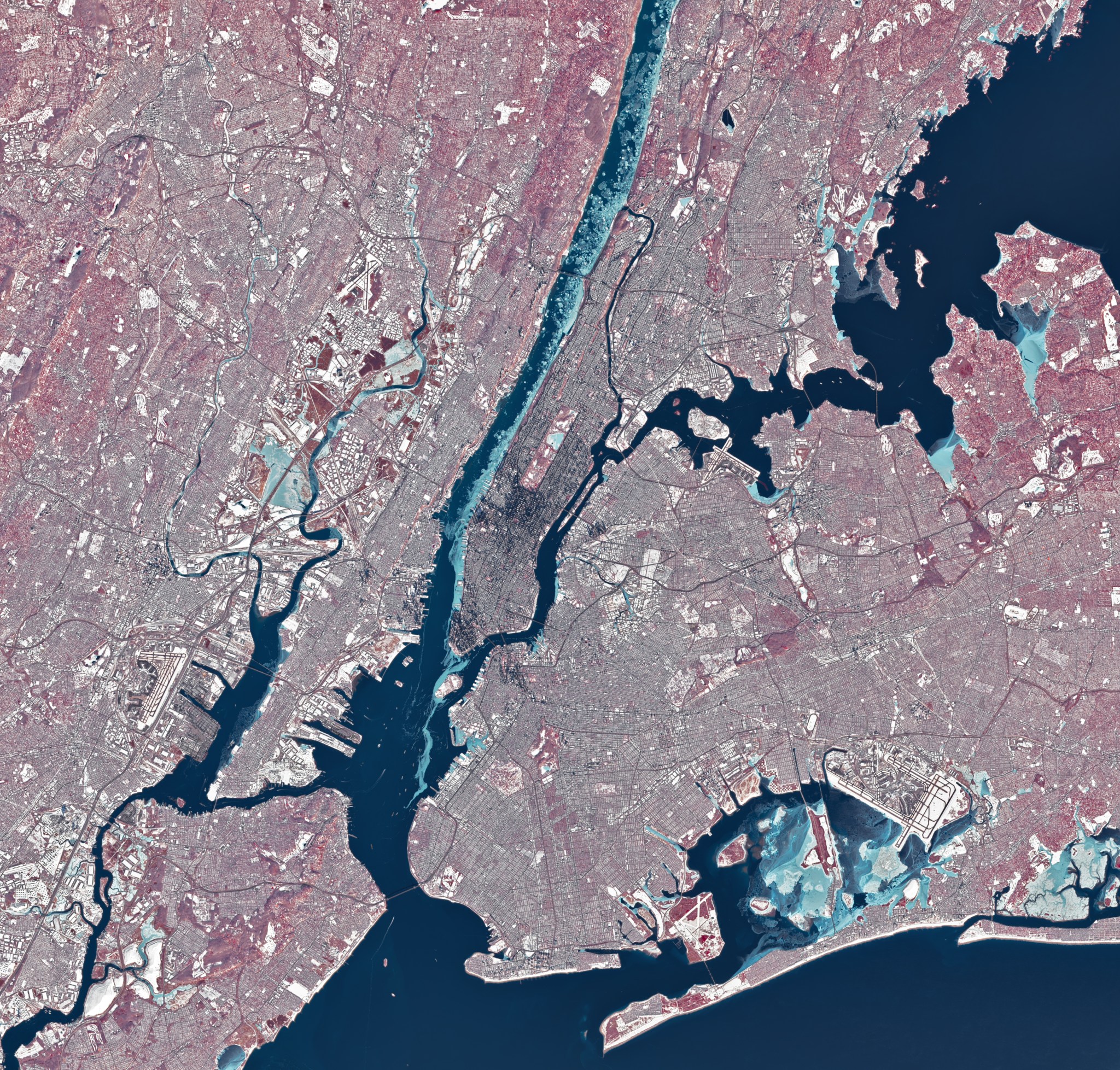
During a stretch of frigid weather in late January 2026, ice choked the Hudson River along Manhattan’s western shore. The OLI (Operational Land Imager) on Landsat 8 captured this image of the wintry landscape around midday on Jan. 28. This image uses representational color to distinguish ice (light blue) from open water and snow. Vegetation appears red. Much of […]
NASA Data Helps Maine Oyster Farmers Choose Where to Grow

NASA satellites are helping Maine oyster farmers pick better sites and plan when oysters will be ready to harvest.