To understand what Americans are experiencing with this winter blast, we need to look more than 20 miles above the surface of Earth, to the stratospheric polar vortex.
…
A 250th anniversary only comes once in a lifetime.
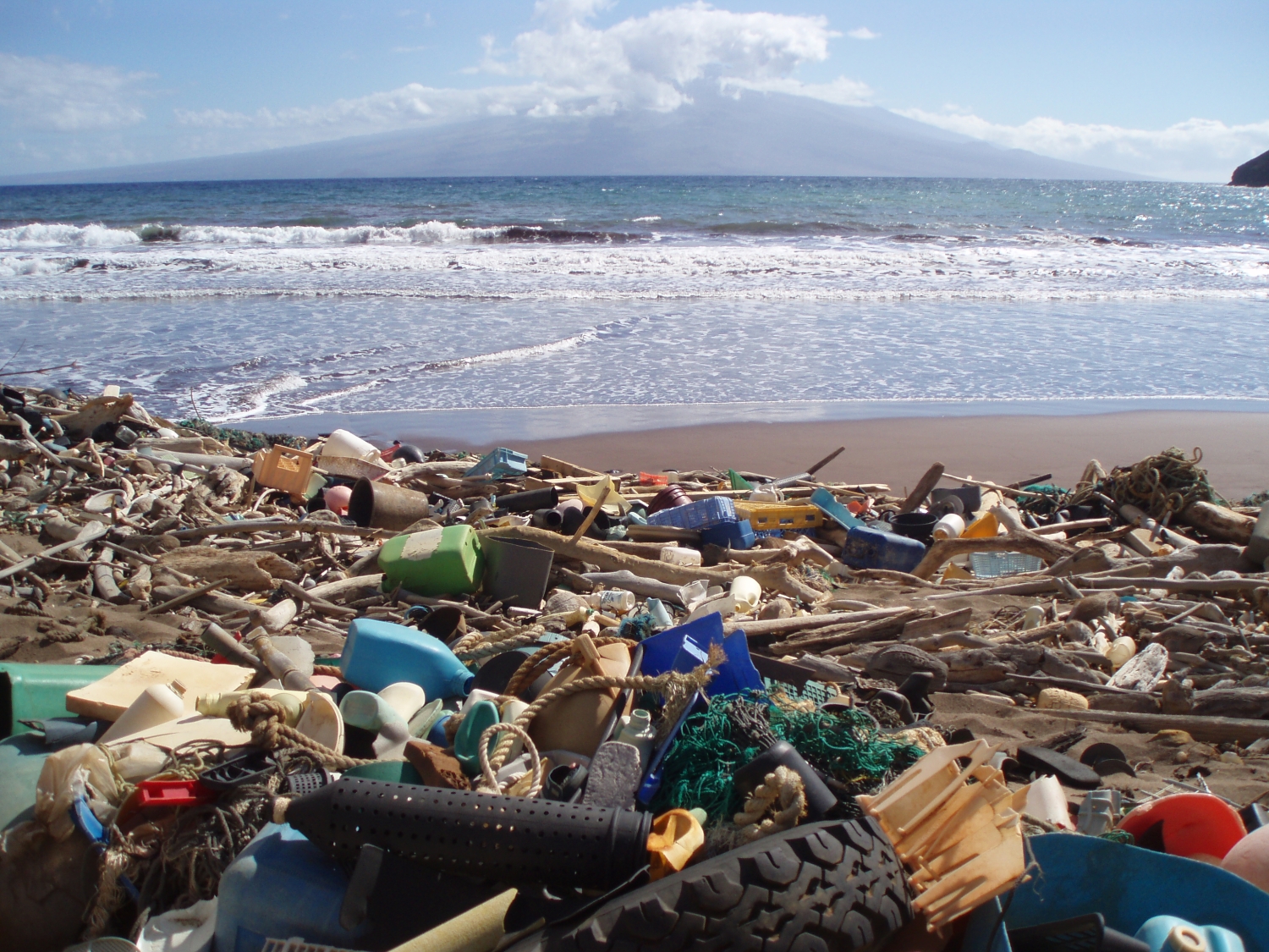
Space-based technology could help track plastic and other flotsam by its ‘fingerprints.’ In late 2025, scientists reported that, for the first time, they were able to detect concentrations of plastic pollution on land using NASA’s Earth Surface Mineral Dust Source Investigation (EMIT) sensor aboard the International Space Station. The technology has inspired marine researchers to […]
Antarctica’s subglacial bedrock was previously one of the least-mapped planetary surfaces in our solar system.

NASA satellites are helping Maine oyster farmers pick better sites and plan when oysters will be ready to harvest.
The image shows just how large and devastating these events can be.

The New York–Newark–Jersey City Metropolitan Statistical Area, which spans 23 counties across New York, New Jersey, and Connecticut and has a population of about 19.9 million, is pictured at approximately 3:29 a.m. local time Dec. 20, 2025, from the International Space Station as it orbited 262 miles above the Atlantic coast. Crew members aboard the […]
Greenland’s mountains greatly affect local climate patterns.
Scientists studying Jurassic rocks in China found that cyclical changes in Earth’s orbit affected not only the climate, but also the development of shale oil reserves.
…
Iceberg A23-A has been around since the Chernobyl explosion and Space Shuttle Challenger accident…but perhaps not for much longer.
…