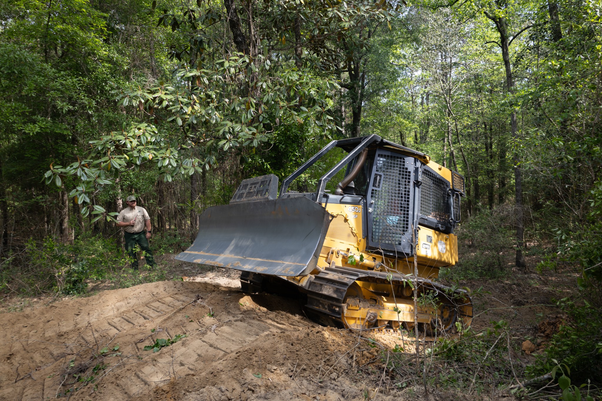
With peak wildfire season approaching, scientists with NASA’s FireSense project have created low-cost thermal sensors to install on fire bulldozers that will alert firefighters when heat from a nearby fire reaches a dangerous level. The sensors also provide researchers with important data on what happens beneath the canopy during a fire. In April, researchers and […]

The Landsat 10 Spacecraft Draft Request for Proposal (DRFP) is available for review via SAM.gov.
Sea level data from a satellite launched by NASA and European partners shows that a swell of warm water hundreds of miles wide has arrived in the Pacific Ocean off the coast of South America, a sign that El Niño will likely emerge later in the year. Because water expands as it warms, a rise […]

NASA’s Boeing 777 has returned to the agency’s fleet after undergoing heavy structural modifications as it transforms from a giant passenger plane into the agency’s next-generation airborne science laboratory. After a check flight and a three-hour transit from Waco, the aircraft returned to NASA’s Langley Research Center in Hampton, Virginia, on April 22. Since January […]

On Jan. 31, students, library staff, researchers, and community members gathered at the University of Florida’s (UF) Marston Science Library for the Environmental Monitoring through Education, Research, and Geospatial Engagement (EMERGE) NASA Data Hackathon. This initiative empowers libraries, educators, and individuals to engage in public health and environmental science using real-world data tools and citizen […]

The bigger the hailstone, the more damage it can cause. But scientists find that predicting hailstone size can be challenging. How quickly does hail melt as it falls?

Two next-generation satellite missions announced Thursday will help NASA better understand Earth and improve capabilities to foresee environmental events and mitigate disasters. “NASA uses the unique vantage point of space to study our home planet to deliver life-saving data into the hands of disaster response and decision-makers every day for the benefit of all, while […]
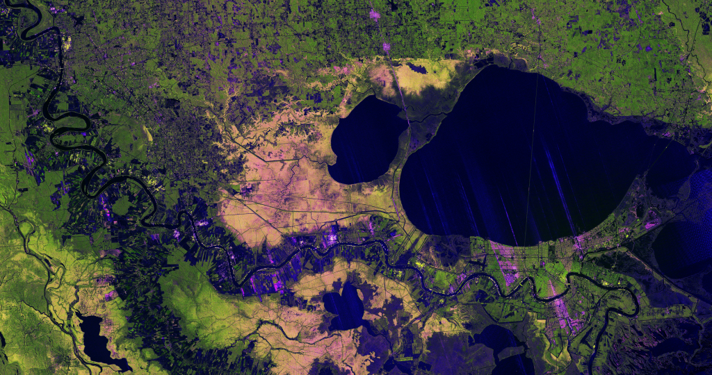
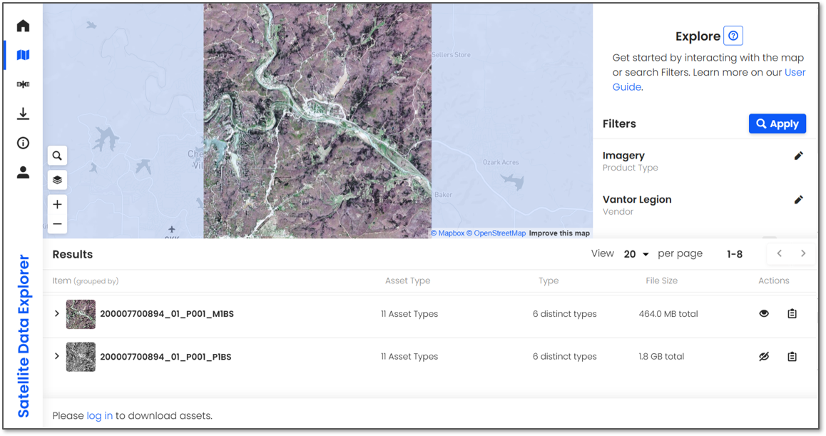
A new image from the NISAR mission shows off the satellite’s ability to reveal details of Earth’s surfaces. The science team also released new sample data. A U.S.-Indian Earth satellite’s ability to see through clouds, revealing insights and characteristics of our planet’s surface, is on display in a colorful, newly released image showing the Mississippi River Delta region in southeastern Louisiana. Created with data collected by the NISAR (NASA-ISRO […]

A mild La Niña caused greater rainfall over the Amazon basin, which offset rising sea levels due to record warming of Earth’s oceans. The rise in the global mean sea level slowed in 2025 relative to the year before, an effect largely due to the La Niña conditions that persisted over most of the year. […]

A team of NASA scientists deployed on an international mission designed to better understand severe winter storms. The North American Upstream Feature-Resolving and Tropopause Uncertainty Reconnaissance Experiment, or NURTURE, is an airborne campaign that uses a suite of remote sensing instruments to collect atmospheric data on winter weather with a goal of improving the models […]