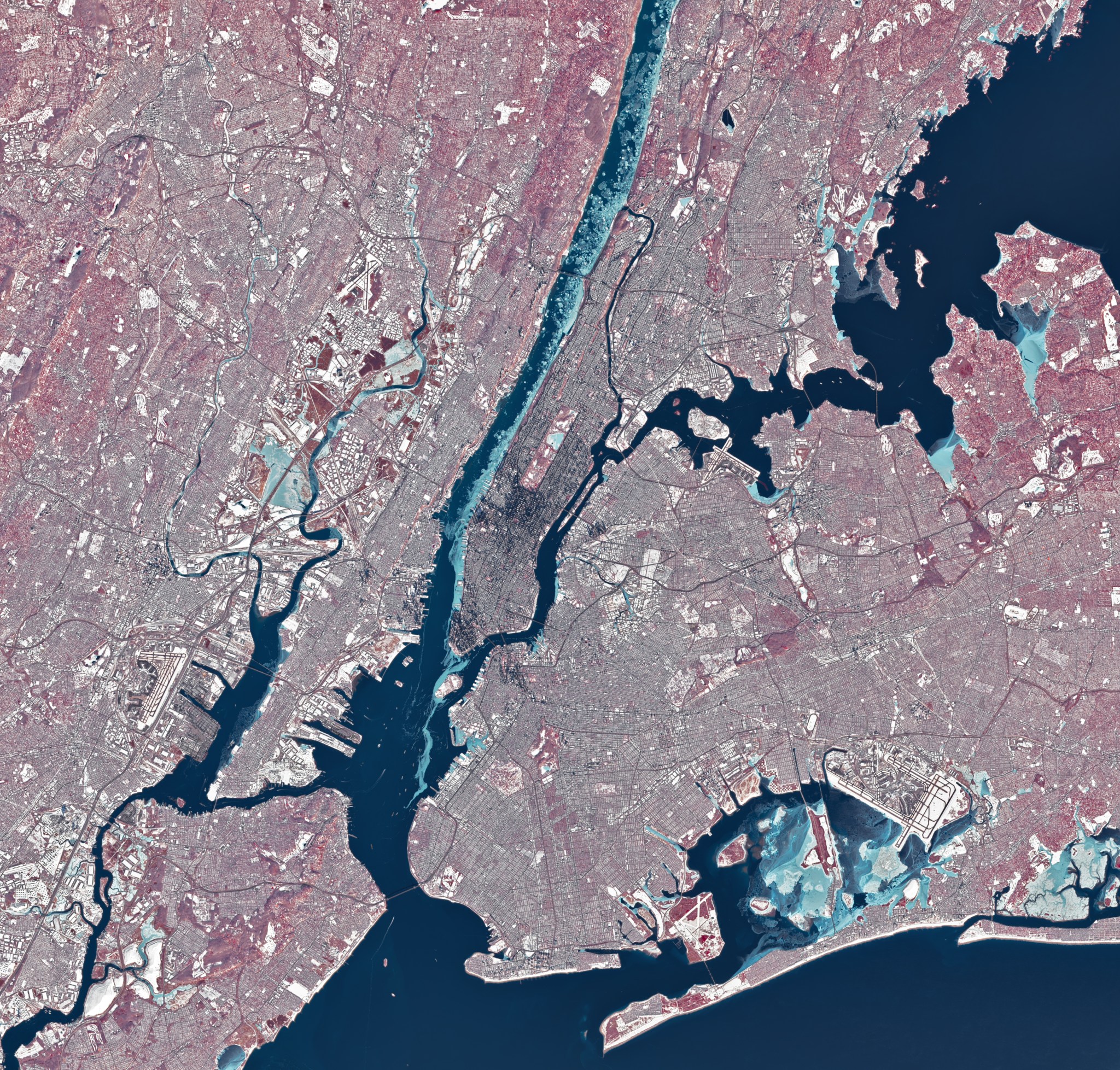
During a stretch of frigid weather in late January 2026, ice choked the Hudson River along Manhattan’s western shore. The OLI (Operational Land Imager) on Landsat 8 captured this image of the wintry landscape around midday on Jan. 28. This image uses representational color to distinguish ice (light blue) from open water and snow. Vegetation appears red. Much of […]
Five ways dismantling NCAR will cost the American people, and two ways to save it.
New research reveals the source of this carbon – and the driving forces behind it – are far more complex than previously thought.
…
A late January 2026 winter storm left more than snow and ice in its wake.

NASA Scientist Alex Gardner highlights how Landsat made his research into the dynamics of glacial flow possible.

NASA’s Libera instrument, which is designed to maintain the global data record of Earth’s radiation budget, has successfully completed comprehensive environmental testing. This critical milestone included thermal vacuum tests that simulate the expected space temperature and environments that Libera will experience during its mission. The Libera instrument will fly on Joint Polar Satellite System-4 (JPSS-4), […]
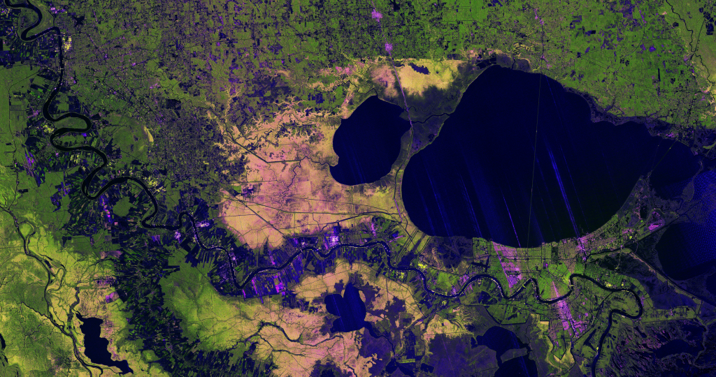
A new image from the NISAR mission shows off the satellite’s ability to reveal details of Earth’s surfaces. The science team also released new sample data. A U.S.-Indian Earth satellite’s ability to see through clouds, revealing insights and characteristics of our planet’s surface, is on display in a colorful, newly released image showing the Mississippi River Delta region in southeastern Louisiana. Created with data collected by the NISAR (NASA-ISRO […]

A total lunar eclipse will redden the Moon on March 3, 2026. Here’s what you need to know.
A mild La Niña caused greater rainfall over the Amazon basin, which offset rising sea levels due to record warming of Earth’s oceans. The rise in the global mean sea level slowed in 2025 relative to the year before, an effect largely due to the La Niña conditions that persisted over most of the year. […]
Along with this stunning image is the first-ever global estimate of river water discharge and overall sediment suspension.
…